Showing posts with label Bike. Show all posts

Sunday, August 21, 2022

2022 Alberta Rockies 700

680 km fire reroute: 2 days 18 hours 48 minutes. 6th place

Strava link: https://www.strava.com/activities/7646389888

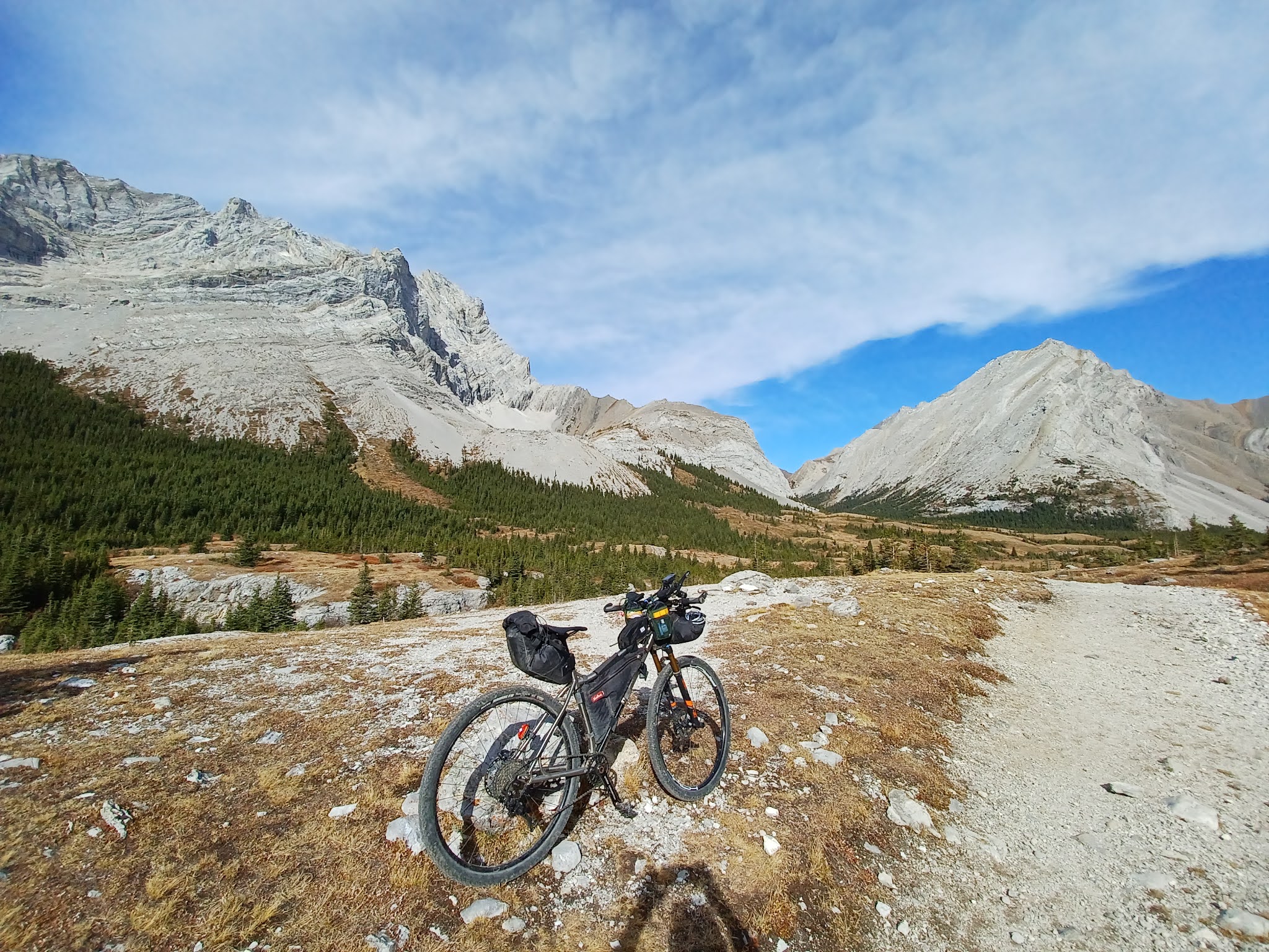
This year I decided to try something different and use a bike with gears. This was my fifth time completing the Alberta Rockies 700. The first four times were on my single speed mountain bike and this time I put an 11-speed cassette on the back.

Look at all that stuff on the back wheel! So complicated.

It started at Rebound Cycle with about 50-60 riders congregating for the starting picture. 

Grand Depart
Photo credit: Kristin Anderson

At the grand depart I was able to meet Majo, who was the first to challenge the GRAAB Gravel Across Alberta Challenge after my inaugural run. It was great to hear his impressions of that route!

Majo and me
Photo credit: Kristin Anderson

The AR700 started with a smooth cruise along the Legacy Trail. It’s about a 20km paved path that goes between Canmore and Banff. This felt like a road ride with the group separating into a couple of pelotons. I was careful not to push too hard with the geared bike. With the single speed (SS), I would have maxed out at a slower speed and ended up near the back of the pack, so gears were nice on this part. 

Glimpse of the Peloton on Legacy Trail

The route then turned back toward Canmore on the Goat Creek Trail. It’s a double track that I’ve ridden many times on other races and rides like the Tour Divide. It was nice to have the easier gears to climb all the hills. I chatted to a few other riders like Colin where this was his first ever bikepacking event and Mike, the owner of Thief Bikepacking bags. I was using some of his product. Good stuff if you are in the market for bags! Colin had a background in off-road motorcycle racing like the Baja. He also participated in ice climbing and rock climbing.

The route continued on to the Spray Lakes and followed a short section of the High Rockies Trail along the water’s edge.
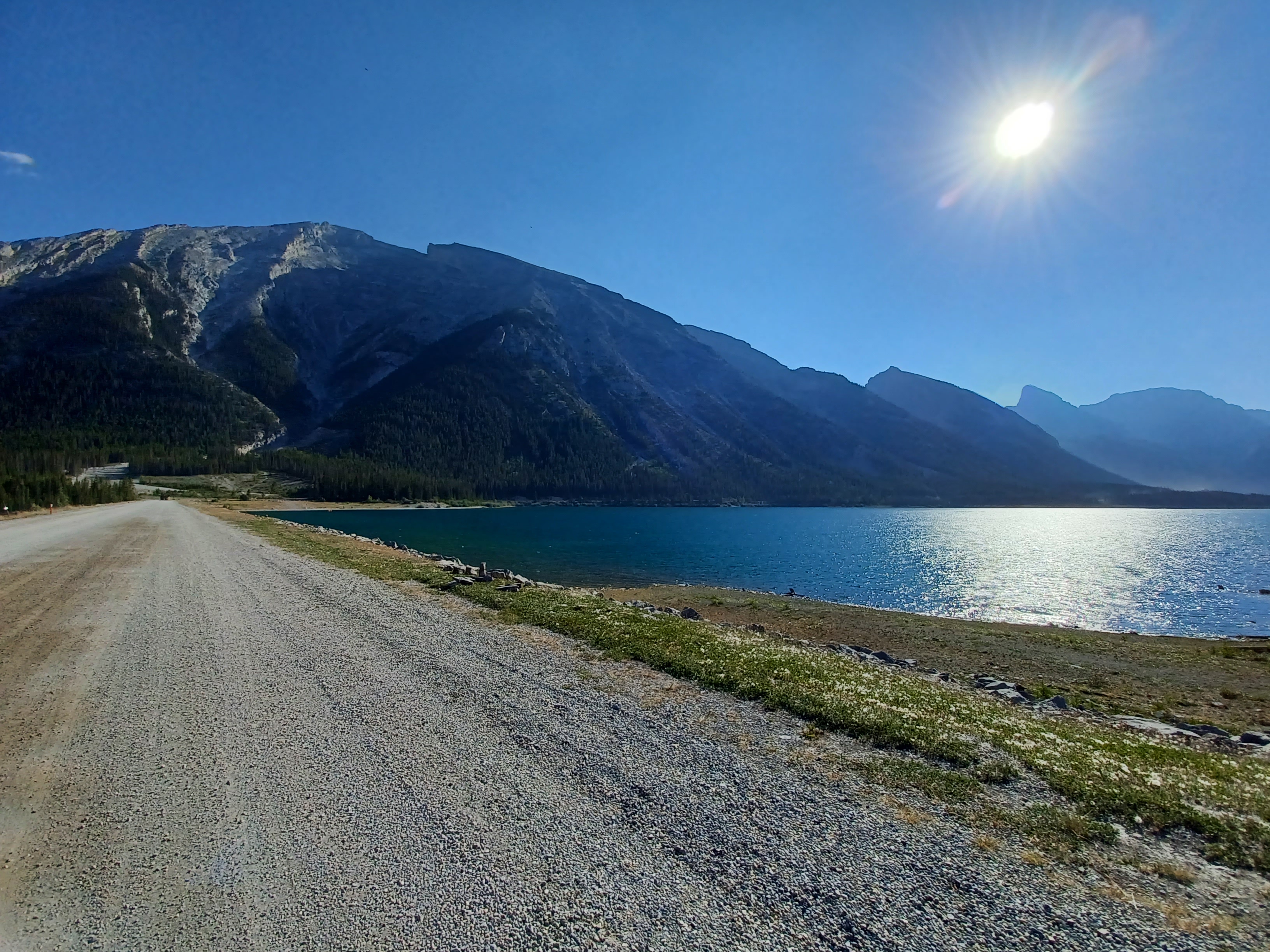
Spray Lakes

Then we were spit out on the dusty, relatively busy Smith Dorrien Road. Not my favorite stretch of road. I was feeling good and took the time with the easy riding to cram some food. I was trying to convince the organizer to avoid this whole stretch of road and follow the High Rockies single track instead but to no avail. At one point, I passed a touring couple with big saddlebags and a “Just Married” sign on the back. As I rolled by, I congratulated both of them and it was nice to see their smiles. I found out on social media after that they were on their way to Mexico.

Dust abounds on the Smith Dorrien Road

Thankfully the time on the Smith Dorrien Road seemed to pass quickly and we were on a short stretch of the High Rockies Trail. Such a fun, twisty, turny, flowy easy single track trail! I talked for a short while to Alistair who I met last year. He ended up having a strong ride finishing on the podium!

Obligatory photo of the High Rockies Suspension Bridge

The route then went into the Peter Lougheed parks and campgrounds following a complicated network of paved trails and roads. I went off route a couple of times due to the many choices of paths to take close to the track on my GPS. I stopped at the Boulton Creek store and chatted with some other riders including Majo and Theo who won the AR700, 700km version last year. We had a small thunderstorm roll by so we huddled under the eave of the store and snacked on junk food. I was off fairly quickly and went on the trails that led to the paved road of Highwood Pass.

I wondered where I was in the standings but was not too concerned. My goal for this race was to see how the geared bike felt and minimize stopped time. At this point I was only at about 20min of stopped time so I felt good about my ride. I also felt good because I was not pushing too hard. It made me wonder if I was not pushing hard enough. All of these thoughts are new to me because with a SS, the bike sets the pace. With gears, I had a choice as to how hard I could go and I had this nagging doubt that I could always go harder. One reason why the SS is more fun and mentally relaxing!

The paved, gentle cruise of Highwood Pass

As I rode, Majo pulled up to me and we leapfrogged all the way to the Highwood House store. On part of the descent, we had some interactions with some cows.

I wasn’t sure if I would make it to the store before it closed at 6pm so was happy I could get some snacks and cold drinks.

Majo!

After Highwood House the route went back on the gravel and back uphill. It was continuing to follow the 500km route until it took a left turn toward Claresholm. Majo caught and passed me at one point and that was the last I saw him since he was doing the 500km race.

I took the 700km route left turn and it continued uphill over a pass and out of the foothills. Beautiful country! 

Climb up to the pass out of the foothills

After the pass, the route steeply descended down some thick, loose gravel. It felt pretty unstable at times, and I had to stay alert so my front tire did not get taken away. It would have been rough to crash at these high speeds! After the steep descent, the slope flattened a bit, but it still was a fast cruise most of the way to Claresholm. I was able to tuck in my aerobars and stay in my top gear. I passed Ian on the gravel, then when we came to the paved road, he passed me. We turned back onto gravel as the sun set and I went ahead again. I cruised on the gravel as the sky went dark and the moon rose. As it peeked above the horizon it was full and a deep red colour. Amazing!

I had enough snacks to make it but knew I was running short on water. We were travelling through farmland so did not have the abundant mountain streams like earlier in the route. I debated about taking the detour off route into Claresholm. At the last turn to Claresholm, I checked my phone and saw a river/creek up ahead and decided to take the chance that I could filter the water. I rode to the bridge, parked my bike, and made my way down to the “river’s” edge. It was a still, brown liquid but deep so I filtered 2L into my hydration pack. My plan was to finish the leftover water in my water bottle and drink this “water” the next day. I would double down and in addition to filtering, add a couple of purification tablets to the 2L of mank.

With my water situation taken care of I started looking for a place to bivy. It was about 1am and I wanted to get about 3.5 to 4 hours of sleep. I didn’t feel tired but knew the sleep would do me good. I found a place in a ditch behind some low-lying bushes.

 Bivy spot for the night among the cow patties

I slept pretty well. Some riders rolled by in the night and the morning but I wasn’t too concerned. If I placed well, that would be nice, but I was trying to just ride my own race. As I slept, I woke to cows breathing heavily over me and walking around. I was happy they were on the other side of the fence.

At 5am, I got up and started rolling. The route was making its way back into the foothills and mountains. It was beautiful country!

On the way back to the mountains

I followed the gravel up a long, steady hill and it was nice to be able to climb it all the way up with the geared bike. If I was on my SS, I would have had to walk the whole thing. I leapfrogged the Block brothers and another rider quickly passed all of us. I met up with Ian again at one point too as he passed me, and I passed him while he got some water at a stream.

I forgot my sheet with the distance between towns so was going on memory. I saw a highway up ahead and thought it was the road leading to Coleman, but I was sorely mistaken. While I thought Coleman was just up ahead, it was actually about 50km away. I was excited to get some fresh water and snack on some new food. The snacks I brought from home were becoming less and less appetizing and I was essentially force feeding myself. I found a stream where I was able to refill my hydration pack with better water and clean off my sweaty face and neck. That felt good!

I still had to traverse another pass along dusty gravel roads that were busy with RV traffic. It was reminiscent of the Smith Dorrien Road. This was a low point for me on the ride. It was hot and I was disheartened when I saw the sign that said it was 35km to Coleman. Up to that point I didn’t know how far away it was and the sign showed me I had a long way to go. I took a few stops at campgrounds to use the bathroom and empty my garbage to break up the monotony.

Eventually I made it to Coleman and it was a relieving sight. I had a gas station pizza sub and some fresh liquids. That pizza sub was the first non-snack food I had for the trip so far! I felt refreshed but I knew I would pay for eating and drinking so much. I tend to overdo it when I feel extra thirsty and hungry. Sure enough, as I left Coleman I felt lethargic and got a case of “pizza sub belly”. As long as I kept pedaling, I would work my way through it.

Up ahead was a route I had not taken before. It was a double track ATV trail that was steadily climbing uphill. It was a lot of fun to ride some more mountain bike-like trails. I much preferred the remote off-road stuff to the dusty gravel roads!! I saw a large coyote on the trail ahead, but it was big enough that it may have been a wolf. I thought it ran off into the trees but for the next few corners I kept seeing it just ahead. I wondered if it was leading me into a pack of its buddies. Thankfully, I did not turn into dog food.

Nice double track after Coleman

There were a few water crossings, and the trail was essentially a stream at some points, but I was enjoying it thoroughly! Then as the sun set, the trail got steeper and steeper, and rockier and rockier. With the geared bike I was able to climb much of the steep trail while I saw many footprints where others chose to walk. But I found the climb was continuing and getting rockier. I decided to start walking like the other riders to change things up and prevent burning out. It was tough to ride and mentally draining to pick a smooth line among the rocks. When you walk, you just walk over all of it and don’t have to think about it too much.  

With the nifty gears most of this was climbable

 One of the rickety bridges

As it got darker, it got rockier

I eventually got to the top of the rough, rocky climb and declared, “I’m never doing that again!” It was dark and now the decision was to descend in the dark. I wasn’t sure if it would be as rocky on the way down because if it was, I’d be walking down too! I decided to go for it and started the descent. There were some sections that I felt should be walked instead of ridden but for the most part, it was not too bad. I got to the end of the ATV trail and got back onto a gravel road.

Periodically I would see these cute little boreal toads along the trail shuffling along.

Boreal toads eating their night insects

I started a climb on the gravel road as it was approaching midnight. I saw lights up high in the distance and wondered what would be so high in the sky. I think it was a mine or something. I was feeling tired after that rocky ATV trail so decided to stop and sleep for a couple of hours. Usually in these 2-3 day races I would only sleep the first night and push to the end but wanted to try sleeping more. Whenever I pushed to the end without stopping for a good sleep, I would be nodding off so much it took a lot of the fun out of the ride.

I stopped on the side of the road out in the open to sleep in my bivy for a couple of hours. It is bear country, so I stopped my bike, pulled out my bivy and walked down the road about 30m to sleep. All my snacks were in my bike, so I wanted to stay away from it while I slept. I was putting my food wrappers in my pocket, so I also took off my shorts and left them on my bike too. I was passed by another rider while I slept for a couple of hours. It was great! I slept well and felt refreshed after I got up!

At about 2am I kept riding up and over a hill and started along the Elk River toward Elkford. It was cold when I got into that valley! I had to put on my puffy coat, gloves, and some toe warmers. After that, I was feeling okay. I rode through the early morning and waited for Elkford to appear. The sun rose and I heard crashing in the bushes a couple of times. Sounds that big were either moose, deer, elk, or bear.

When the trail turned onto some single track, I knew I was close since I did this part last year! Elkford came into view, and I rolled up to the gas station at about 6:30am. It was bustling with workers getting their lunches and snacks for the day. There were lots of catchy sayings like “working hard or hardly working” and “living the dream” being tossed around. They had some microwavable meals, so I had my first real breakfast the whole trip, potatoes, eggs and bacon bathed in hot sauce.

Real food is good!! Note the bike in the window.

I thanked the ladies working in the restaurant without calling them “princess” like the many workers passing through and was on my way satisfied.

Just as I left town, I ran into Neil. I have known Neil for several years in the bikepacking community through Bikepack Canada Summits and overnight trips but had never run into him in an event. He was doing the 500km route. It was nice to chat! We leapfrogged one another from this point all the way to the end.

 Neil!

The route gradually climbed up some single track and with the geared bike, it was nice to climb it all. I remember riding this at about the same time of day as last year and feeling really tired. But today I felt great! That 2 hour sleep was doing wonders for my alertness.

View from the top of the Elkford single track

After the single track I knew it was a fairly long stretch of undulating gravel roads along the Elk Valley that gradually climbed over Elk Pass.


Elk Valley gravel

At one point I started to feel tired and nod off. I stopped in a small field of daisies on the side of the road and took a 10 minute nap. After that I felt really good again. A while later at Tobermory Cabin I felt tired again so took another nap on the picnic table. I also filled up with water here from the stream.

Snacking on chips close to Elk Pass

Eventually I came to Elk Pass Arch. I arrived at the same time as Ethan from California, and he was gracious enough to take my picture with my GRAAB finisher’s shirt. The arch is the start of GRAAB and the last time I was here was last September when I rode that route for the first time. 

The start of GRAAB!
Photo credit: Ethan Albrecht

After Elk Pass, I could see the end in sight! Skogan Pass was the last major pass to go! I descended the other side of the pass with Ethan and we marveled at some big bear tracks in the dried mud. Ethan was concerned about bears, but I tried to reassure him that there is not much to worry about if you respect them and give them their space.

Big bear and slightly less big bear tracks

We passed back through the center of the figure eight of the course as we travelled past the Boulton Creek store. I had enough food and water to continue on, so I did not stop. The route went along some paved roads, and I was feeling good to be almost done! I thought maybe I’d be done by midnight!

I turned onto highway 40 and chatted with a cycling tourist from Los Angeles. He had been touring the area on his Surly Long Haul Trucker with panniers front and back.

 Sheep ahead!

There they are

The route turned off the highway and went on a fun bit of single track toward Fortress Ski area and Kananaskis Village. 

 Bridge leading to the single track

 Some of the rockiness

I had a lot of fun on this part! The trail flowed well and had some good viewpoints. I was glad it was more technical than a gravel road, so I did not have the chance to get sleepy. 

View as the single track passed the golf course

There were nice, paved trails around Kananaskis Village. I started climbing Skogan Pass and was curious to see what the footing was like. The last time I was there was for an October training ride for the 2016 Tour Divide. It was snowy and the footing below felt uneven. This time I was happy to see the smooth surface. I could ride a lot of it and walk a lot of it at a quick pace compared to the nasty ATV hike-a-bike before Elkford.

 Pristine, smooth surface of Skogan Pass

There was a lot of bear scat around, so I was yelling, “Hey bear,” every several minutes. I got to the top at sunset and then the descent was fast and smooth. 

Near the top!

There were a lot of moths that would go up in front of me as I zipped down the other side. I continued to yell, “Hey bear,” a lot because there was tall, thick grass where a bear could easily hide. It was a long, fast descent. I stopped a couple of times to rest my hands from braking so hard.

Hey bear!!!!

When I got to the bottom, I thought I was almost finished, but I knew there was a single track trail coming up. I was hoping it would be a fast one. I was getting hungry and was trying to eat, but didn’t want any more of my food. It was getting harder to swallow without water. I almost heaved from eating a Hot Rod.

I tried to find the trail to the single track called Guy Lafleur. There was a rickety plywood bridge across a fast-moving stream. 

Ride it! Nope!!

I hoped it was a fast, flowing singletrack but sadly, that wasn’t the case. It was a lot of short, steep climbs that I had to push my bike up. There were big roots so I couldn’t get any significant motion for much of the trail.

I saw 3 or 4 boreal toads that were cute that shuffled off the trail. One of them I had to take evasive action to avoid so I didn’t crush it. 

Save the toads!

Eventually I came out in the Three Sisters Village and thought the single track was done! But then the track started going back up the mountainside to Highline Trail. Sadness! Again, the hope was that it was fast and flowy. Again, that was not the case. It was similar to Guy Lafleur except instead of roots it was rocks, so very slow going.

After an hour and a half of pushing my bike up steep climbs and riding some of it, there was a really fun downhill section that finished at Quarry Lake. Along the way, a tiny little mouse jumped out in front of me! This little mouse was just sending it around the berms. It really stood out among the lights and the white, dusty trail. I slowed down a bit to watch it go, then it went off into the trees. Keep shredding little mouse!

Those last two stretches of single track were relatively soul crushing when I thought I was almost done. Both locals familiar with the route and finishers thought it was a cruel addition when the town was in sight. Once I got past Quarry Lake onto the road, I was sooo happy the single track was finally over.

The route snaked through town on some of the nice, smooth pathways. Kristin, Evan, and Megan greeted me at 1:43 AM with Evan holding a “Congratulation!” sign he made. I was elated to be done! 

Elation!!

Congratulation!

Neil arrived about 15 minutes later and we complained together about the end. Misery loves company! That was a tough one! Kudos to everyone who made it!

Neil and me with feelings of intense relief

-----

Epilogue:

So you might be wondering what the verdict is between gears and SS! Well, each has advantages for different types of rides, but I’ll be using SS for my next bikepacking event. Gears were nice for the sustained downhills and technical climbs, but sitting all the time killed my butt. 

I also find the simplicity of SS very relaxing and it makes the ride more fun. I don’t need to think about which gear to be in and wonder if I should go harder or easier. On a SS, it is what the bike is and there is no choice. It leaves more time to enjoy nature, the surroundings, and the riding itself. I’ll use gears on my fatbike and road bike, and put gears on the Unit X for tours and bikepack trips with other people, but when it comes down to riding for myself, SS for the win!!

Monday, October 4, 2021

2021 GRAAB Challenge - Gravel Across Alberta


The GRAAB Challenge – Gravel Across Alberta was certainly that, a challenge!

The Origin

I dreamt up this idea because I wanted to ride across Alberta. I thought there must be a good way to get across AB on the road less travelled and why not take pictures of interesting landmarks on the way. Elk Pass seemed like the best choice to start since it is on the border of BC and it’s not on a busy road. With the BC-AB border snaking along the Rocky Mountains, there are not many crossing points that are not backcountry hiking trails or busy highways. Next, I looked for a finish point. Of all the border towns along the southern part of the AB-SK border, what better finishing landmark than the World’s Largest Bunnock in Macklin, SK. Then I searched for interesting landmarks between those two points and pieced together a route that stayed on gravel or off road most of the way. Overall, it was a success! Even though there were some paved roads, they were either not busy or had a big enough shoulder that I never felt like I was on a heavily traveled road the whole ride.

The Trial Run

I posted the 601km route to social media and made a Facebook page at www.facebook.com/GRAABchallenge. I wanted the route to be out there for others to try but for it also to be a laid-back challenge. I thought a Facebook page would be a fun way for those that ride the route to post their photos of the landmarks and anyone could do it whenever they wanted. People could do it at a touring pace or at a faster race-ish pace. If going fast, times could be compared for the all so important bragging rights. Lol!

My schedule worked out and I was able to give it a shot during a fall weekend! It would be so exciting to see the varying landscape of Alberta in the fall colors! I wanted to do it as fast as I could but also take care of myself a bit better than some other rides like this that I have done. That means a bit more sleep. And I did sleep a bit more…although only a little bit more. I also stopped for meals more often than I would usually do on these kinds of rides. It was nice to just ride at my pace without having the race mentality. Go as quick as you can but stop and smell the roses (or maybe the freshly made Subway sandwich -YUM).

Another fairly new thing to me was using a geared bike. I typically ride single speed but wanted to give this gear thing a try. I managed to source an XT shifter and derailleur and Dale at Rollingdale Cycle added them to the bike.

Gears, what a novelty!

My wife Kristin and sister Joyce dropped me off at the Elk Pass trailhead on Friday morning. Before even starting the GRAAB, I had to ride about 5.5km and 270m of climbing. It was a bit cold, 5°C, so I didn’t mind warming up with a bit of a climb. The fall colours already were breathtaking! This stretch of trail is part of the Tour Divide and Alberta Rockies 700 so it was familiar territory.

On the way up!

The ride to the top took about 40 minutes. Once at the top, I took my photos, turned around and went back the way I came. The inaugural GRAAB ride begins!

Landmark 1. Elk Valley Arch

The first selfie!

Starting time 9:37am September 24, 2021

I zipped down the hill excited to see what was in store for me over the next couple of days. I travelled down the double track I just came up, then turned into some gentle single track through Peter Lougheed Provincial Park. This is such a nice portion of trail that winds through the pine forest. I went down into the Boulton Creek Campground and up Whiskey Jack Trail until I got to Hwy 40. This is a short segment of pavement until the route turns left onto the steeeep climb up to Elbow Lake. The mountains were amazing in the morning sun. Typically, the forest is all green on the sides of the mountains. At this time of year there were these strips of gold going up the mountainside with the leaves changing colour.

Hwy 40: Pictures never do it justice!

I turned onto the rocky double track that led up to Elbow Lake. Steep, steep, steep. With the geared bike I was able to climb most of it, but when I felt like I was working too hard, I got off and walked. I had to make sure not to burn any matches. There was still a long way to go! The trail was pretty busy with hikers, horses, and one other guy on a bike. As I walked up a steep climb, I chatted with a guy and his two young children. Those kids were doing awesome with their big packs!

First view of Elbow Lake

Once I got to Elbow Lake, I was blown away with how beautiful it was! I rode the other way on this trail during the Alberta Rockies 500 COVID Edition in 2020 but did it in the middle of the night, so I missed all the scenery.

Another view of Elbow Lake

Yet another view of Elbow Lake. The view blew me away!

The trail led me into a flat, open section with mountains towering on either side. I’ll say it again, it was awesome! The trail was quite rocky, and I was thinking how this might be on a gravel bike. I was pretty happy with my 50mm wide tires and suspension fork. You may be able to ride a skinnier tire gravel bike, but it would probably be pretty rough. This rough, rocky trail continued all the way to the Little Elbow campground. If you are going to do this route on a rigid, skinny tire gravel bike, beware of this section!

Open meadow. Amazing!

See the gold and reds!

I chatted with the other biker, and he seemed surprised I was going to Saskatchewan. I carried on and was enjoying the downhill bits through the big rocks. Fun!

The trail snakes down into the valley

I cruised down through the valley and was very happy this section is on the route! It’s a fantastic section to showcase the Rocky Mountains. As I was zipping down the trail, I noticed I was off route. Typically in a bikepacking race, I would have to go back and get on the route. In the GRAAB, going off route a little bit is no big deal, so I stayed on my trail. It was a nice little section of single track that I would alter the route to take when I got back home. 

Singletrack reroute looking back

Singletrack looking forward. Gorgeous bit of trail.

I bombed down the rocks toward the Little Elbow campground. I was enjoying this thoroughly! Another thing that was different with the geared bike is the ability to gear up. I was holding 30-35kph on some of the downhill sections. I had to be careful not to push too hard. That’s where a single speed is nice. It keeps you from working too hard on the easy sections so gives you a chance to recover.

New bridge across the river

There were a few river crossings that were not very deep except for one. I managed to ride through the deep one but saturated my shoes and socks. The water went up to just below my hubs. I hoped my shoes and socks would dry out before it got too cold at night. At one point as I was flying down a gradual downhill, I saw a group (or is it a pack?) of horses and riders. Since horses are living beings and I didn’t want to startle them, I stopped on the side of the trail and let them pass. I don’t know much about horses and didn’t know how they would react to a bike flying by at 30kph. The cowpeople (politically correct way of saying cowboy since there were male and female riders) seemed appreciative. I think I will add stopping for horses to my list of riding policies alongside never riding over Texas gates in my aerobars.

Bridge at Little Elbow Campground

After the Little Elbow Campground, the gravel roads begin! I knew I would miss the mountain biking but was looking forward to some faster speeds. The route turned onto Powderface Trail. It was nice to settle into the rhythm of climbing and descending on the gravel.

Lots of this on Powderface Trail

After Powderface, there was a bit of pavement on Sibbald Creek Trail. It was a nice break after all the elevation of the day. I could see the mountains getting a bit smaller as I made my way into the foothills.

Sibbald Creek Trail. I continued to be blown away by the fall colours!

Just before Cochrane, I stopped to use the facilities (a bush) and checked my cell reception. I had some so I posted my Elk Pass photos to the GRAAB Facebook page. The scenery was opening up and I was starting to see more farmland.

The start of many wide open prairie views

I got to Cochrane about 5:00 or 5:30 and started riding on their local foot paths. The route showed going on the road at one part so I would have to change the route when I got home. As I crossed a road, I saw an A&W down the street. Food! I went down to the little complex, resupplied at the gas station and had a sub at Subway. In Cochrane, I had to find the Men of Vision Cowboy. I tried to make the route go past all the landmarks, but the Cowboy is up on a hill off the trail. I tried taking a selfie from the bottom of the trail but the picture looked lame, so I went up the hill to get right beside the statue.

Lame selfie from the trail

Much less lame selfie

The Cochrane cowboy looks off into the sunrise contemplating life

I left Cochrane with a full belly and good spirits. I climbed as the sun set and was looking forward to seeing Airdrie.

Cochrane at sunset

The tailwind was strong that night, my friends. I whipped down the roads toward Airdrie enjoying the easy, fast pedaling. I got into Airdrie about 11:00pm and wanted some more food. I saw a Co-op gas station, but it was closed. I was happy to see that the Tim Hortons next door was not! I got some supper and breakfast and filled up my water. I would usually call Kristin while I ate, but there was a pack of youths nearby swearing and being loud like kids do at that age. I ate my sandwich amused by the youths posturing amongst themselves by being as annoying and loud as possible. I remember those irrational, carefree days.

After eating I kept riding on the paths of Airdrie slaloming around more disenfranchised youths in the dark (ringing my bell of course). I got to the Korean Totem Poles and crossed another landmark off the list.

I am agape like the totems!

Korean Totem Poles

Bridge across Hwy 2

I continued through Airdrie on my way to Irricana still enjoying the tailwind. I arrived at Old Smoky the Horse at about 12:30am and took my photos. I wondered if anyone saw me and thought it was strange some guy on a bike was taking selfies with a horse statue in the middle of the night.

Nut on a bike by Old Smoky the Horse

Old Smoky the Horse!

I went on to look for the truck and tractor on a pole only a couple of kilometers away. When I got where they were supposed to be, there was nothing there except an auto recycling yard. I went up and down the road in the dark looking for them to no avail. They must have torn them down for this auto yard. They would have to be removed from the list.

Auto recycling yard where the truck and tractor on a pole should be

On to Beiseker. I went to see Squirt the Skunk. Squirt was the start and finish of the Hurt’n Albert’n 550 (HA550) that I rode a few years back, so I knew he was in the little campground in town. I rode into the campground and wanted to get a couple hours of sleep. I took my photos and looked for a bush to sleep beside.

Selfie with Squirt

Squirt in the dark. No lights, so I'm shining my headlight on him.

I rolled out my bivy and laid down to sleep. I did not sleep very well. It felt like I did not sleep at all, but when I checked my watch, I actually slept through my alarm! It was a very weird sleep. I packed up in about 6 minutes and headed down the road about 5:00am. It was pretty warm! Overnight, it only got to down to about 15C. I rode for a little while, then stopped to eat my wrap I bought in Cochrane for breakfast.

There was one stretch of road that I struggled with hard on the HA550. It’s long and straight, with lots of big up and down climbs. Not mountain-size climbs but still pretty big. This time doing it was not as bad as back in the HA550, but it was still challenging. One silver lining to this piece of road, was I was riding it during sunrise. As the sun came up, the sky glowed in oranges and reds. Being in the prairie now the sky was huge! The prairie stretched out for miles and miles. On the top of one ridge, I looked back and actually saw the small sawtooth of the mountains in the far distance!

Sunrise looking toward the sun

Sunrise looking away from the sun. The whole sky was alive with colour!

I arrived in Drumheller at about 10:30am Saturday morning. I found the Circle K closest to the route and loaded up on some food. I saw a plug behind a nasty, slimy garbage can so plugged my battery pack in and slid the garbage can in front…with my foot. I talked to Kristin while eating my warm ham and cheese burgers. They were actually pretty good! When I was in the store, I saw a Peace Officer and wondered if he would comment on my bear spray prominently displayed on my shoulder strap. It’s a more common sight in the Rockies but probably not in the Badlands. I wondered, but he didn’t say anything. After eating I rolled down the road to the World’s Largest Dinosaur and took my pictures.

The fear is real! That inanimate plaster dinosaur might get me!

The World's Largest Dinosaur!

After the climb out of the river valley Drumheller rests in, the elevation profile is quite flat. I expected to go faster for the remainder of the route. It’s the prairies - it should be flat and it’s all on gravel roads. But then there was the wind. It was so nice to have a tailwind up to this point, but now it shifted into a full-on headwind. The stretch I thought was going to be fast ended up being a slow grind as I was buffeted by the gusts of wind. To add to that, most of the roads were freshly graded so I had to plow into the wind and plow through the thick layer of gravel. I was hard-pressed to get my speed up to 18kph.

Thick gravel and wind in the face, but the scenery was still fabulous!

I kept plugging away. Any progress is good progress. I would make it to Hanna eventually. At one point, I felt tired, so took a nap on the side of the road behind a bush. The grass was already packed down, so it was probably a deer bedding spot. Just after I started riding, a small deer jumped out of the bushes and ran off. Maybe we were both taking a nap.

I eventually got to Hanna about 7:00pm. This was the last stop for resupply until the finish which was about 220km away. I got some snacks at a gas station and bought a couple of footlongs at Subway. While I chowed down on my sub, I told Kristin about the soul-sucking wind and gravel all the way here. I was scared the next 100km segment to Veteran would have the same disheartening wind. After dinner, I went to the second Hanna goose and got my pictures.

The goose attacked! It must have heard my disparaging comments about Nickelback.

Hanna goose taking off into the sunset

Thankfully, the wind died down to a less demoralizing level. Darkness fell and I was blessed with a clear sky and bright moon and stars. The moon was bright enough that I could dimly make out the terrain. There was also a relief from the thick gravel. Some of the section roads went through farmers fields. They consisted of mostly dry clay. This would be hard if it was wet, but it was dry for me, so I rejoiced whenever the route took me on these less maintained roads. Since they went through farmer’s fields I had to open and close several gates along the way.

Don't free the bovines!

At about 10pm, I was feeling tired, so I rolled out my bivy for a sleep on the side of the road. I slept about an hour and started packing up. The clear sky was beautiful but that also made it quite cold – about 3°C. I put on some warm gear and started pedaling to Veteran. The sleep monster hit me hard that night. About every 1-1.5 hours I would start nodding off. Whenever this happens, my policy is to stop and take a 10-minute nap. The road was flat and fairly fast but with the naps, I took longer than I hoped to get to Veteran. But I got there eventually!

Do you see the fatigue in my eyes?

The illuminated Poppy

I was cold and hungry, so I searched the small park nearby for some shelter to eat and take a nap. Then out of the darkness a glorious thing appeared! An outhouse… Just kidding; it was a fully enclosed picnic shelter to protect me from the cold wind. The shelter was located amongst a group of RVs. It was about 5:00am so I did not want to wake anyone up. It felt like I was tiptoeing around a group of sleeping hippos (that’s the closest animal I could think of that resembles an RV) trying not to wake them up. When I approached the picnic shelter, I slid open the barn door and it emitted a loud fingernail-on-chalkboard squeaking noise. Don’t wake the hippos! Thankfully, none awoke, and I was able to eat my sub and sleep on the picnic table for about half an hour without being disturbed. There was even a plug inside, so I was able to charge my battery pack a bit too.

My sanctuary from the cold, cold wind

I left Veteran at about sunrise and rode down a nice stretch of pavement. These little bits of pavement were nice reprieves from soft gravel roads.

Swamp reflecting sunrise

Thankfully, the headwind died down a bit. I turned off the pavement and was back on gravel. My spirits were high after the sanctuary in the picnic shelter. The wind was even cooperating! It shifted into a fairly strong south wind. My route was either going North or East, so I either had a tailwind or crosswind. I’ll take it! I stopped in this area to have a nice conversation with a cow. On these long rides, the cows are nice creatures to talk to and break up the boredom. I can’t remember why I stopped or what I was talking to the cow about, but she was very attentive and listened well. I was just about to pack up and ride off when the cow made a coughing noise and a bunch of liquid poured out of her mouth. That must be what chewing cud looks like. I bid her farewell and was on my way.

Gravel for miles and miles

The elevation profile for this section to the finish in Macklin showed some pretty significant peaks and I wondered what it would be like. I hoped I would not be plowing through fresh gravel and I got my wish. The route started following more less-used roads that are primarily used by farmers and gas or oil service workers. And it was sandy, very sandy. I loved it! It was nice being on these remote roads. Some sections were thick with sand and had to be walked, and some were a bit overgrown with bushes, but I loved the remoteness and they were fun to ride.

Sandy terrain. Wonderful!

Getting sandier!

And even sandier! I had to walk through this bit.

Some sections were a bit overgrown. Beautiful in the Fall!

As I got closer to Macklin, the service roads ended, and I was back on some thick gravel. That didn’t bother me though. I was almost done! I got to the border of Saskatchewan and wanted to take a picture at the “welcome” sign. But guess what? There wasn’t one. I guess they only have those on the major roads. The only indication I crossed the border was two signs on either side of a range road. The AB sign was blue and started at 10 and the SK sign was green and ended at 3290.

AB and SK RR signs

Almost done! I snaked my way through the sleepy town of Macklin and arrived at the Bunnock! A majestic 30-foot-tall bone in the prairies never looked so good. Kristin and Joyce were there and had a cold Coke and container of fruit for me. The Coke tasted extra sweet since I just ran out of all my water. The GRAAB Challenge was complete in 2 days, 7 hours and 1 minute!
Done at 4:38pm on Sunday, Sept 26th, 2021

Bunnock selfie

Victory at the Bunnock!